
.
The island nation of Sri Lanka in the Indian Ocean has several small offshore islands and islets as well as islets in its various bays and lagoons.
I have listed below, in alphabetical order, most of the known islands (and islets) lying in the waters of the Gulf of Mannar on the western coast of Sri Lanka. Please note that this list is not comprehensive.
Mannar District, Northern Province
- Kalliaditivu / Galadi doova, 1.71 sq km, 8°56′54″N 79°54′42″E.
- Mannar Island / Mannaram doopatha, 126.46 sq km, 9°03′10″N 79°49′42″E.
- Puliyantivu / Kotidoova, 0.90 sq km, 8°57′19″N 79°54′01″E.
Puttalam District, North Western Province
- Ambanttativu / Sambanda-doova, 0.17 sq km, 8°12′40″N 79°46′06″E. In Puttalam Lagoon.
- Erumaitivu / Mahisadoova, 0.90 sq km, 8°16′07″N 79°46′44″E. In Dutch Bay.
- Henativu / Havativu / Haavadoova, 0.78 sq km, 7°58′22″N 79°49′09″E. In the channel between Puttalam Lagoon and Mundal Lagoon.
- Ippantivu / Ibbandoova, 0.76 sq km, 8°19′49″N 79°48′22″E. In Dutch Bay.
- Karaditivu / Karadiva, 0.09 sq km, 7°54′42″N 79°48′54″E. In channel between Puttalam Lagoon and Mundal Lagoon.
- Karaitivu, 8°27′45″N 79°47′15″E. West of Portugal Bay.
- Mantivu / Maandoova, 0.38 sq km, 7°42′03″N 81°39′43″E. In the channel between Puttalam Lagoon and Mundal Lagoon.
- Maripututivu / Maliputhu diva, 0.10sq km, 8°10′33″N 79°44′59″E. In Puttalam Lagoon.
- Mattutivu / Maddu doova, 0.12sq km, 8°13′02″N 79°47′00″E. In Puttalam Lagoon.
- Neduntivu / Maedundoova, 0.10 sq km, 8°14′06″N 79°46′45″E. In Dutch Bay.
- Oddakarentivu / Uddakadoova, 0.20 sq km, 8°16′37″N 79°45′54″E. In Dutch Bay.
- Periya Arichchal / Maha Arakgala,0.32 sq km, 8°17′59″N 79°47′45″E. In Dutch Bay.
- Periyativu / Mahadoova, 1.10 sq km, 7°56′57″N 79°48′58″E.
- Pullupiddi / Kotipitiya, 0.11 sq km, 8°11′21″N 79°46′40″E. In Puttalam Lagoon.
- Sinna Arichchal / Podi Arakgal, 0.16 sq km, 8°17′02″N 79°47′32″E. In Dutch Bay.
- Udayurputi / Udukurupoththa, 0.42 sq km, 8°10′07″N 79°48′31″E. In Puttalam Lagoon.
Mannar Island

Of these listed islands, Mannar Island is the largest having an area of 48.83 square miles (126.46 sq km). It is a part of Mannar District. It is linked to the main island of Sri Lanka by a causeway.
The island is dry and barren, mainly covered with vegetation and sand.
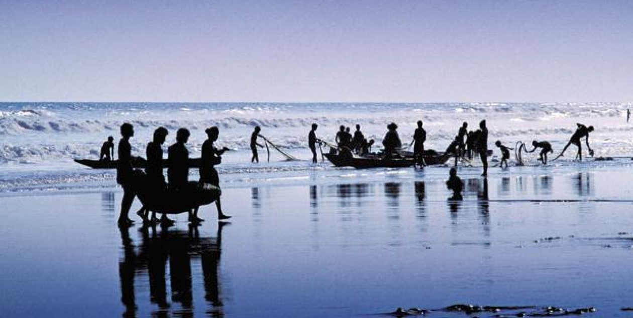
The main occupation of the people living in the area is fishing.
Major settlements are Mannar and Erukkulampiddi on its eastern coast, and Pesalai on its northern coast. All these towns are connected by the A14 road which leads across the bridge to mainland Sri Lanka.
.
← Previous: Part 2 – The 21 Islands of India
.
RELATED ARTICLES
- Islands in the Gulf of Mannar: Part 1 – Adam’s Bridge (tvaraj.com)
- Islands in the Gulf of Mannar: Part 2 – The 21 Islands of India (tvaraj.com)
- Gulf of Mannar (en.wikipedia.org)
- Adam’s Bridge (en.wikipedia.org)
- Mannar Island (en.wikipedia.org)
- List of islands of Sri Lanka (en.wikipedia.org)
.


8 thoughts on “Islands in the Gulf of Mannar: Part 3 – Islands and Islets of Sri Lanka”